| Home | |
| Ullapool | |
| Grandchildren | |
| Archie WWI | |
| Archeology | |
| Switzerland | |
| Family Tree | |
| Contact | |
| Archie WWI | |
| My Father's Memoirs | |
| Book Review | |
| Cartoons from Signals Section | |
| Christmas Card | |
| Cartoon Card | |
| Newspaper Cutting | |
| Area around Ypres |
The On-line Home of Anna Welti
Here is a map of the battlefield area around Ypres taken from the 'Times' newspaper on 26 April 1915.
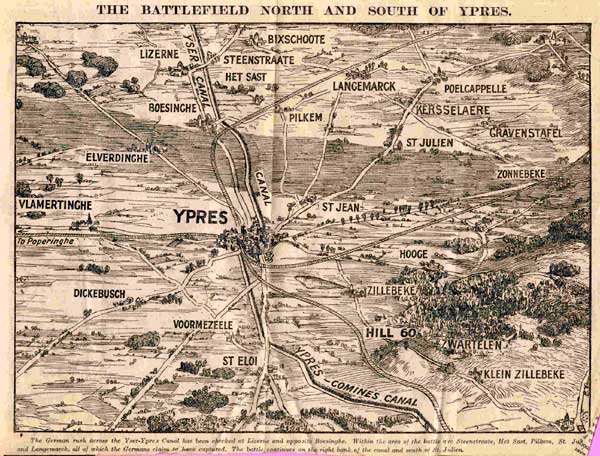
The German rush across the Yser-Ypres canal has been checked at Lizerne and opposite Boesinghe. Within the area of the battle, are Steenstraate, Het Sast, Pilkem, St. Julien, and Langemarck, all of which the Germans claim to have captured. The battle continues on the right bank of the canal and at St. Julien.
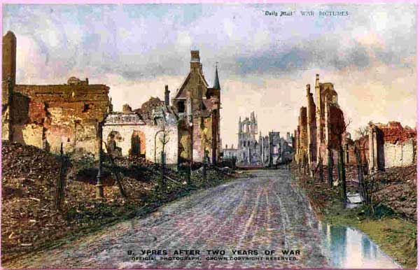
Here is a picture of Ypres after 2 years of war taken from the 'Daily Mail'.